
A New Frontier in Aerial Data: Insights from Rocky Mountain LiDAR's Push for BVLOS OPS
At Sun Dog Imagery, our commitment has always been to cutting-edge aerial perspectives. Lately, much of our focus has been dedicated to advancing the broader field of aerial intelligence, culminating in my exciting role at Rocky Mountain LiDAR. We are constantly pushing the boundaries of what's possible in aerial data acquisition, and today, we're excited to share a groundbreaking development that's set to redefine precision and efficiency for our organization: our application for Beyond Visual Line of Sight (BVLOS) drone operations with the FAA. This initiative is poised to unlock unprecedented capability for highly accurate 3D data collection across the nation.
Understanding the Power of Aerial LiDAR
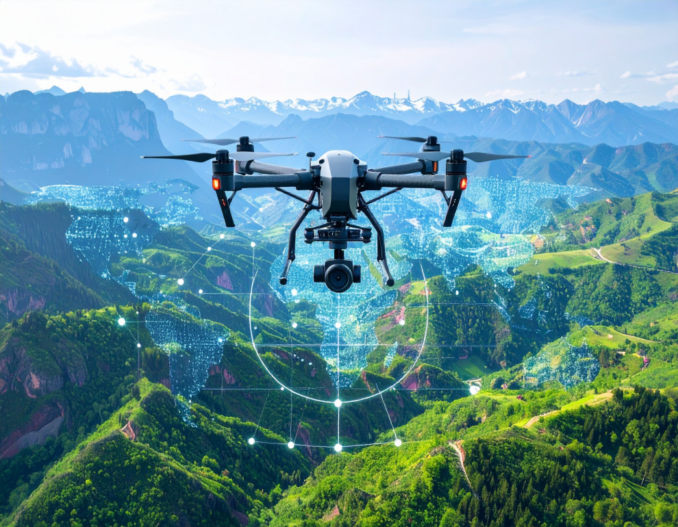
Rocky Mountain LiDAR specializes in capturing the most precise 3D spatial data using advanced aerial LiDAR technology. Unlike traditional photography that captures light and color in stunning visuals, LiDAR uses laser pulses to create incredibly accurate digital representations of terrain, infrastructure, and objects, forming what's known as a 'point cloud'. This dense collection of millions of data points provides exact measurements and detailed models.
This precision data is crucial for projects requiring exact measurements, detailed volumetric calculations, precise mapping of complex terrain, and comprehensive infrastructure inspections. Our expertise supports critical industries such as oil and gas, renewables, transmissions, engineering, and survey support, empowering informed decision-making and optimizing project outcomes nationwide.
The BVLOS Advantage: Why This is a Game-Changer
Currently, most drone operations in the United States are restricted to Visual Line of Sight (VLOS), meaning the pilot must maintain constant visual contact with the drone. While effective for many projects, this limits the scale and efficiency of large-area data collection, especially in the vast and often rugged landscapes of the Rocky Mountain region.
Our pursuit of BVLOS certification is a strategic move to overcome these limitations. This capability will allow Rocky Mountain LiDAR to deploy our advanced LiDAR sensors over much greater distances and larger project areas—like long linear corridors or extensive survey zones—in a single, continuous mission. We are requesting to conduct BVLOS operations primarily in Class G airspace, including sparsely populated rural areas, remote locations with limited accessibility, and linear infrastructure corridors such as power lines, pipelines, and roadways.
The strategic benefits this brings to clients are significant:
Unmatched Efficiency: BVLOS operations significantly increase efficiency by reducing flight segments. This is crucial for projects like collecting data along power lines, pipeline corridors, and large land parcels, where continuous data capture is vital without frequent repositioning of ground crews.
Cost-Effectiveness: By minimizing launch/recovery sites and crew deployments, we can reduce overall project costs.
Superior Data Quality: BVLOS operations improve data quality by maintaining consistent flight parameters over extended areas.
Enhanced Safety: We can minimize exposure of personnel in potentially hazardous or remote terrains during data acquisition.
Access to New Frontiers: This enables data acquisition in difficult terrain and unlocks entirely new applications previously impractical for drone LiDAR.
The Rigor of Innovation: Our Commitment to Safety and Technology
Developing and submitting our BVLOS program to the FAA has been a meticulous and rigorous process. It reflects Rocky Mountain LiDAR's unwavering commitment to both innovation and the highest standards of safety and regulatory compliance.
Our application details a comprehensive approach to safety, including:
Advanced Equipment: We utilize the DJI Matrice 350 RTK platform, chosen for its redundant systems and advanced obstacle avoidance. It is capable of up to 55 minutes flight time. We also employ a DJI RTK 2 Mobile Station for precise centimeter-grade accuracy, essential for positioning and enhanced safety. The Matrice 350 RTK also features a reliable DJI O3 Enterprise Transmission system for stable command and control (C2) link, with a transmission range of up to 20 km (12.4 miles).
Experienced Personnel: Rocky Mountain LiDAR was established in 2024 and operates with the extensive experience of 11 professionals, including licensed land surveyors and seasoned aviation personnel. Our operations will be managed by experienced FAA Part 107 certified pilots, Devin Day and David Kessner. All flight crew members must possess a Part 107 certification before their start date and undergo a comprehensive BVLOS training program, including a minimum of 10 hours of On-the-Job Training (OJT) before qualifying as an RPIC for BVLOS missions.
Safety Management System (SMS): Rocky Mountain LiDAR has implemented a comprehensive SMS, built on FAA-recommended pillars of Safety Policy, Safety Risk Management, Safety Assurance, and Safety Promotion. This system ensures a proactive and continuous approach to hazard identification, risk assessment, and mitigation.
Risk Mitigation Strategies: We implement thorough pre-flight planning, detailed airspace analysis, meticulous airspace deconfliction, reliable lost-link protocols with automated Return to Home (RTH), and strict weather limitations. Our drones are programmed with pre-set lost-link behaviors like RTH, hovering, or landing, and pilots are extensively trained in these procedures. Operations are limited to daylight hours only and under Visual Meteorological Conditions (VMC), with a maximum wind speed of 28 mph and a minimum visibility of 3 statute miles. No operations will be conducted in heavy rain, snow, fog, or thunderstorms.
Detect and Avoid (DAA) Capabilities: While our primary DAA relies on proactive planning and procedural mitigations, our DJI Matrice 350 RTK features six-directional sensing and positioning (binocular vision and infrared sensing), as well as CSM Radar support for obstacle avoidance. We are also exploring future integration of ADS-B (Automatic Dependent Surveillance-Broadcast) receivers to enhance detection of cooperative aircraft.
My Role in This Evolution: Business Development and Beyond
My position as Business Development Manager for Rocky Mountain LiDAR involves understanding our clients' most complex challenges and showing how cutting-edge aerial intelligence, particularly through LiDAR and advanced operational capabilities like BVLOS, provides the solutions. Overseeing the FAA BVLOS application has been a primary focus, embodying our commitment to innovation and delivering unparalleled value. My background as an RPIC provides a unique perspective on the operational complexities and safety considerations that go into building a program of this magnitude.
We believe that BVLOS operations are crucial for efficiently acquiring comprehensive LiDAR and photogrammetry data over the large-scale linear corridors and extensive survey areas typical of our projects. This initiative positions Rocky Mountain LiDAR as an emerging leader in advanced aerial mapping and surveying, and as a company committed to providing state-of-the-art geospatial data solutions nationwide.
Partnering for Precision: What This Means for Your Projects
We are incredibly excited about the future of aerial LiDAR and the enhanced value we'll bring to our partners. If approved, Rocky Mountain LiDAR's BVLOS capabilities will unlock new levels of precision and scale, fundamentally changing how large-scale aerial data is acquired. We are confident that our enhanced safety measures, advanced technology, experienced personnel, and comprehensive procedures demonstrate our ability to conduct these operations safely and in the public interest.
If you have a project that could benefit from cutting-edge aerial LiDAR data, I encourage you to reach out to us at Rocky Mountain LiDAR. Let's discuss how we can help you achieve your project goals with unparalleled accuracy.